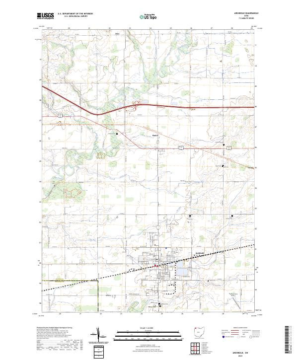
2023 Map of Archbold
USGS Topo · Published 2023About this map
Archbold serves as the central hub of this Northwest Ohio landscape, situated where the Tiffin River and a network of agricultural drainage ways like Grass Run and Flat Run define the terrain. The map captures a high density of small family and community burial grounds, providing an exceptional resource for genealogists tracing regional lineages. These sites, including Lauber Hill Cem, Wyse Cem, and Beck Cem, are scattered across the township grid, reflecting the early settlement patterns of the area.
Find a feature on this map
85 named features on this map. Tap any name to fly to it.
Don’t see what you’re looking for? This feature index may not catch every label — zoom into the map to look around manually.
Map Details
Editions of this 2023 Archbold Map
This is the sole edition of this map. No revisions or reprints were ever made.