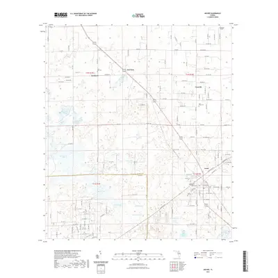
2021 Map of Archer
USGS Topo · Published 2021About this map
Archer and Newberry anchor this portion of the Florida landscape, where the Alachua and Levy county line intersects a terrain defined by sinkhole ponds and traditional cemetery sites. The geography is punctuated by numerous named water bodies, ranging from the large Watermelon Pond and Horseshoe Pond to smaller features like Half Moon Pond and Gosman Pond. These depressions are characteristic of the regional karst topography, creating a patchwork of wetlands and open water. Educational and religious institutions serve the local community, including the Santa Fe College Davis Center and several historically significant burial grounds such as Saint Mark Cem and Saint Peter's Cem. The transition from rural homesteads to more established settlements is evident near Pinesville and the crossroads at Half Moon, while the intersection of SW Archer Rd and local routes like Co RD 28 provides the primary framework for contemporary navigation and property boundaries.
Find a feature on this map
119 named features on this map. Tap any name to fly to it.
Don’t see what you’re looking for? This feature index may not catch every label — zoom into the map to look around manually.
Map Details
Editions of this 2021 Archer Map
This is the sole edition of this map. No revisions or reprints were ever made.
Other maps of this area

1890 · Arredondo
USGS Topo · 1:62,500

1892 · Arredondo
USGS Topo · 1:62,500

1894 · Arredondo
USGS Topo · 1:62,500

1895 · Williston
USGS Topo · 1:62,500

1954 · Bronson
USGS Topo · 1:24,000

1954 · Gainesville
USGS Topo · 1:250,000

1955 · Bronson NE
USGS Topo · 1:24,000

1958 · Gainesville
USGS Topo · 1:250,000

1959 · Gainesville
USGS Topo · 1:250,000

1966 · Gainesville West
USGS Topo · 1:24,000