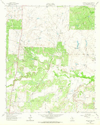
1963 Map of Archer City NE
USGS Topo · Published 1964About this map
The Little Wichita River meanders across this Archer County landscape, defining a region where cattle ranching and petroleum extraction defined the local economy in the early 1960s. Large holdings such as the Mule Shoe Ranch, Coleman Ranch, and Edwards Ranch represent the enduring pastoral character of North Texas. The map captures a moment when the Old Railroad Grade remained a visible scar on the terrain, tracing former transport routes through the brushy draws.
Find a feature on this map
22 named features on this map. Tap any name to fly to it.
Don’t see what you’re looking for? This feature index may not catch every label — zoom into the map to look around manually.
Map Details
Editions of this 1963 Archer City NE Map
This is the sole edition of this map. No revisions or reprints were ever made.
Other maps of this area

1931 · Archer City
USGS Topo · 1:62,500

1954 · Wichita Falls
USGS Topo · 1:250,000

1956 · Sloop Creek
USGS Topo · 1:24,000

1956 · Lake Wichita
USGS Topo · 1:24,000

1957 · Wichita Falls East
USGS Topo · 1:62,500

1957 · Wichita Falls West
USGS Topo · 1:62,500

1958 · Wichita Falls
USGS Topo · 1:250,000

1962 · Windthorst
USGS Topo · 1:24,000

1963 · Scotland
USGS Topo · 1:24,000

1963 · Archer City East
USGS Topo · 1:24,000