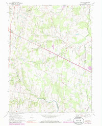
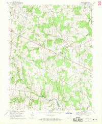
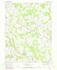
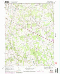
1968 Map of Arcola
USGS Topo · Published 1985About this map
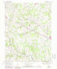
Dulles International Airport dominates the eastern edge of this Northern Virginia landscape, showing the massive facility's footprint shortly after its opening. This mid-century survey captures a region in transition, where the historical rural character of Loudoun County meets modern infrastructure. Landmarks like Oak Hill (Historical) and Mt Zion Ch reflect the area's deep heritage, while the presence of the State Prison Camp No 26 and various substations indicate shifting land use. The topography is defined by the drainage systems of Broad Run and Bull Run, with traditional crossroads settlements such as Arcola and Gilberts Corner still serving as primary local centers. Many family-named sites and small cemeteries are visible, offering a detailed record for researchers tracing the evolution of these communities before later suburban expansion transformed the territory.
Find a feature on this map
29 named features on this map. Tap any name to fly to it.
Don’t see what you’re looking for? This feature index may not catch every label — zoom into the map to look around manually.
Map Details
Editions of this 1968 Arcola Map
5 editions found
Other maps of this area

1884 · Harpers Ferry
USGS Topo · 1:125,000

1890 · Mt. Vernon
USGS Topo · 1:125,000

1891 · Harpers Ferry
USGS Topo · 1:125,000

1891 · Mt. Vernon
USGS Topo · 1:125,000

1893 · Frederick
USGS Topo · 1:125,000

1893 · Harpers Ferry
USGS Topo · 1:125,000

1894 · Warrenton
USGS Topo · 1:125,000

1894 · Frederick
USGS Topo · 1:125,000

1894 · Mt. Vernon
USGS Topo · 1:125,000

1897 · Mt. Vernon
USGS Topo · 1:125,000