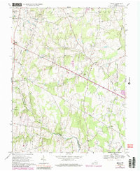
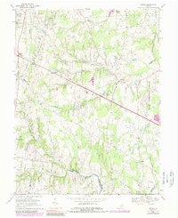
1968 Map of Arcola
USGS Topo · Published 1989About this map
The Dulles International Airport boundary dominates the eastern edge of this landscape, marking a period of significant transition for eastern Loudoun County. This mid-century survey captures the rural character of the region before suburban expansion, centered around the historic village of Arcola and the settlement at Lenah. The landscape is defined by the drainage of Broad Run and its tributaries, including South Fork Broad Run and Foley Branch.
Find a feature on this map
29 named features on this map. Tap any name to fly to it.
Don’t see what you’re looking for? This feature index may not catch every label — zoom into the map to look around manually.
Map Details
Editions of this 1968 Arcola Map
5 editions found
Other maps of this area

1884 · Harpers Ferry
USGS Topo · 1:125,000

1890 · Mt. Vernon
USGS Topo · 1:125,000

1891 · Harpers Ferry
USGS Topo · 1:125,000

1891 · Mt. Vernon
USGS Topo · 1:125,000

1893 · Frederick
USGS Topo · 1:125,000

1893 · Harpers Ferry
USGS Topo · 1:125,000

1894 · Warrenton
USGS Topo · 1:125,000

1894 · Frederick
USGS Topo · 1:125,000

1894 · Mt. Vernon
USGS Topo · 1:125,000

1897 · Mt. Vernon
USGS Topo · 1:125,000