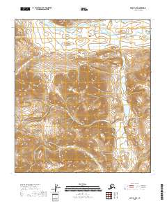
2018 Map of Arctic B-5 SE
USGS Topo · Published 2018About this map
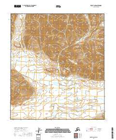
The Junjik River flows across the northern reaches of this landscape, carving through a high-elevation interior in the North Slope Borough. This area is defined by sharp topographic relief and the headwaters of alpine drainages, including the eastern descent of Crow Nest Cr. In the northeastern corner, Timber Lake sits as a high basin landmark among the steep contours. The map primarily documents the raw physical geography of this remote Arctic environment as it was recorded by the U.S. Geological Survey in 2018. While devoid of man-made structures or settlements, the detailed contour intervals provide a clear view of the mountain passes and watercourses that shape this part of the Brooks Range foothills.
Find a feature on this map
11 named features on this map. Tap any name to fly to it.
Don’t see what you’re looking for? This feature index may not catch every label — zoom into the map to look around manually.
Map Details
Editions of this 2018 Arctic B-5 SE Map
This is the sole edition of this map. No revisions or reprints were ever made.
Other maps of this area

1951 · Arctic
USGS Topo · 1:250,000

1956 · Arctic
USGS Topo · 1:250,000
1972 · Arctic A-4
USGS Topo · 1:63,360
1972 · Arctic A-5
USGS Topo · 1:63,360
1981 · Arctic B-5
USGS Topo · 1:63,360
1983 · Arctic B-4
USGS Topo · 1:63,360
2018 · Arctic B-5 NE
USGS Topo · 1:25,000
2018 · Arctic A-4 NW
USGS Topo · 1:25,000
2018 · Arctic B-4 SW
USGS Topo · 1:25,000
2018 · Arctic B-4 NW
USGS Topo · 1:25,000