
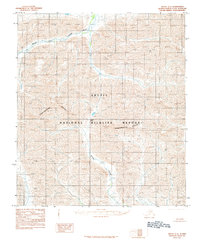
1983 Map of Arctic C-3
USGS Topo · Published 1984About this map
The Continental Divide cuts diagonally through this high-latitude terrain, marking a fundamental geological boundary within the Arctic National Wildlife Refuge. Based on 1974 photography, this topographic record reflects a landscape defined by extreme elevation and drainage patterns rather than human habitation. Glacial runoff feeds into named watercourses like Cane Creek and Flatrock Creek, which navigate the complex contours of the North Slope. The absence of roads or settlements underscores the protected status and isolation of this interior wilderness during the late twentieth century. For researchers or conservation historians, the document provides precise data on mountain peaks and the structural spine of the Brooks Range as it existed before contemporary climate shifts influenced sub-arctic hydrology.
Find a feature on this map
6 named features on this map. Tap any name to fly to it.
Don’t see what you’re looking for? This feature index may not catch every label — zoom into the map to look around manually.
Map Details
Editions of this 1983 Arctic C-3 Map
This is the sole edition of this map. No revisions or reprints were ever made.
Other maps of this area

1951 · Arctic
USGS Topo · 1:250,000

1956 · Arctic
USGS Topo · 1:250,000
1983 · Arctic B-4
USGS Topo · 1:63,360

1983 · Arctic B-2
USGS Topo · 1:63,360
1983 · Arctic D-2
USGS Topo · 1:63,360

1983 · Arctic C-2
USGS Topo · 1:63,360

1983 · Arctic B-3
USGS Topo · 1:63,360
1983 · Arctic D-4
USGS Topo · 1:63,360
1983 · Arctic D-3
USGS Topo · 1:63,360
1983 · Arctic C-4
USGS Topo · 1:63,360