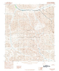
1983 Map of Arctic D-3
USGS Topo · Published 1984About this map
The Continental Divide cuts through this high-latitude terrain of the North Slope, separating the drainage systems of the eastern Brooks Range. This 1983 provisional survey highlights the protected status of the land within the Arctic National Wildlife Refuge and the Arctic Wildlife Refuge Wilderness. Waterways like the Canning River, Red Sheep Creek, and Cane Creek serve as the primary landmarks in an area defined by elevation and its proximity to the Wilderness Boundary. The map's contour lines illustrate the stark vertical relief of the mountains before they descend toward the coastal plain. For researchers, this document captures the administrative and environmental state of this wilderness just as modern conservation boundaries were being formalized.
Find a feature on this map
7 named features on this map. Tap any name to fly to it.
Don’t see what you’re looking for? This feature index may not catch every label — zoom into the map to look around manually.
Map Details
Editions of this 1983 Arctic D-3 Map
This is the sole edition of this map. No revisions or reprints were ever made.
Other maps of this area

1951 · Arctic
USGS Topo · 1:250,000

1951 · Mt. Michelson
USGS Topo · 1:250,000

1956 · Arctic
USGS Topo · 1:250,000

1956 · Mt. Michelson
USGS Topo · 1:250,000

1983 · Mount Michelson A-3
USGS Topo · 1:63,360

1983 · Mount Michelson A-2
USGS Topo · 1:63,360

1983 · Arctic C-3
USGS Topo · 1:63,360
1983 · Arctic D-2
USGS Topo · 1:63,360

1983 · Arctic C-2
USGS Topo · 1:63,360
1983 · Mount Michelson A-4
USGS Topo · 1:63,360