
1983 Map of Mount Michelson A-2
USGS Topo · Published 1983About this map
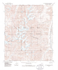
The Franklin Mountains dominate this high-latitude terrain within the Arctic National Wildlife Refuge, where the landscape is defined by its dramatic relief and glacial drainage patterns. Flowing northward through the eastern edge of the quadrangle, the Hulahula River is a primary waterway, while the Canning River carves through the southwestern corner, both serving as major arteries in this protected wilderness. The drainage network is further intricately mapped through named tributaries such as Carnivore Creek, Katuk Creek, and West Patuk Creek. This 1983 edition, based on 1972 aerial photography, captures the designated Arctic Wildlife Refuge Wilderness in its contemporary state, showing a roadless expanse of unsurveyed land lines under the Umiat Meridian, where peaks and ridgelines remain the only structural landmarks.
Find a feature on this map
12 named features on this map. Tap any name to fly to it.
Don’t see what you’re looking for? This feature index may not catch every label — zoom into the map to look around manually.
Map Details
Editions of this 1983 Mount Michelson A-2 Map
2 editions found
Other maps of this area

1951 · Arctic
USGS Topo · 1:250,000

1951 · Mt. Michelson
USGS Topo · 1:250,000

1955 · Mount Michelson B-1
USGS Topo · 1:63,360

1956 · Arctic
USGS Topo · 1:250,000

1956 · Mt. Michelson
USGS Topo · 1:250,000

1956 · Mount Michelson B-2
USGS Topo · 1:63,360

1956 · Mount Michelson B-3
USGS Topo · 1:63,360

1983 · Mount Michelson A-3
USGS Topo · 1:63,360
1983 · Mount Michelson A-1
USGS Topo · 1:63,360
1983 · Arctic D-2
USGS Topo · 1:63,360