
1956 Map of Mount Michelson B-3
USGS Topo · Published 1966About this map
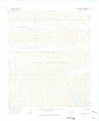
The Arctic National Wildlife Range occupies the vast majority of this 1956 landscape, a territory defined by the dramatic ascent of the Third Range. This remote interior section of the North Slope reveals a complex drainage network where the Sadlerochit River and its tributaries, such as Snow Creek and Whistler Creek, carve through the high mountain terrain. The map details the expansive Ikiakpaurak Valley and Ikiakpuk Valley, which served as natural corridors through the wilderness long before formal infrastructure arrived. These topographical details, captured from aerial photographs and field-annotated in the mid-1950s, record the region's natural state at the dawn of modern conservation efforts. Other notable water features include Fire Creek, Gravel Creek, and Eagle Creek, each tracing the narrow valleys between towering peaks.
Find a feature on this map
13 named features on this map. Tap any name to fly to it.
Don’t see what you’re looking for? This feature index may not catch every label — zoom into the map to look around manually.
Map Details
Editions of this 1956 Mount Michelson B-3 Map
2 editions found
Other maps of this area

1951 · Mt. Michelson
USGS Topo · 1:250,000

1955 · Mount Michelson C-3
USGS Topo · 1:63,360

1955 · Mount Michelson C-4
USGS Topo · 1:63,360

1955 · Mount Michelson C-2
USGS Topo · 1:63,360

1956 · Mt. Michelson
USGS Topo · 1:250,000

1956 · Mount Michelson B-2
USGS Topo · 1:63,360

1975 · Mount Michelson C-3
USGS Topo · 1:63,360

1978 · Mount Michelson C-4
USGS Topo · 1:63,360

1983 · Mount Michelson A-3
USGS Topo · 1:63,360

1983 · Mount Michelson A-2
USGS Topo · 1:63,360