
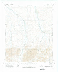
1978 Map of Mount Michelson C-4
USGS Topo · Published 1984About this map
The Canning River defines the western edge of this subarctic landscape within the Arctic National Wildlife Range. Flanked by the towering peaks of the Sadlerochit Mountains and the Shublik Mountains, the region is bisected by the prominent Ignek Valley. The topography is shaped by complex drainage systems, where Ignek Creek and Nanook Creek carve through the foothills between massive ranges.
Find a feature on this map
13 named features on this map. Tap any name to fly to it.
Don’t see what you’re looking for? This feature index may not catch every label — zoom into the map to look around manually.
Map Details
Editions of this 1978 Mount Michelson C-4 Map
This is the sole edition of this map. No revisions or reprints were ever made.
Other maps of this area

1951 · Mt. Michelson
USGS Topo · 1:250,000

1955 · Mount Michelson C-5
USGS Topo · 1:63,360

1955 · Mount Michelson C-3
USGS Topo · 1:63,360

1955 · Mount Michelson D-5
USGS Topo · 1:63,360

1955 · Mount Michelson D-3
USGS Topo · 1:63,360

1955 · Mount Michelson C-4
USGS Topo · 1:63,360

1955 · Mount Michelson D-4
USGS Topo · 1:63,360

1956 · Mt. Michelson
USGS Topo · 1:250,000

1956 · Mount Michelson B-3
USGS Topo · 1:63,360
1971 · Mount Michelson B-5
USGS Topo · 1:63,360