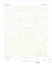
1956 Map of Mount Michelson B-3
USGS Topo · Published 1975About this map
The Arctic National Wildlife Range dominates this mid-century landscape of the North Slope, revealing a wilderness of unnamed peaks and high valleys. The Third Range runs across the center of the sheet, separating the Ikiakpaurak Valley to the north from the Ikiakpuk Valley to the south. This terrain is defined by its drainage patterns, most notably the Saddlerochit River which carves through the eastern portion of the quadrangle. The map reflects a moment in 1956 when the area remained entirely without roads or permanent settlements, documented by the U.S. Geological Survey through aerial photography. Instead of infrastructure, the sheet records the natural intersections of waterways like Cache Creek, Eagle Creek, and the distant Whistler Creek, showing the unpeopled character of the Brooks Range foothills before the expansion of North Slope industrial activity.
Find a feature on this map
11 named features on this map. Tap any name to fly to it.
Don’t see what you’re looking for? This feature index may not catch every label — zoom into the map to look around manually.
Map Details
Editions of this 1956 Mount Michelson B-3 Map
2 editions found
Other maps of this area

1951 · Mt. Michelson
USGS Topo · 1:250,000

1955 · Mount Michelson C-3
USGS Topo · 1:63,360

1955 · Mount Michelson C-4
USGS Topo · 1:63,360

1955 · Mount Michelson C-2
USGS Topo · 1:63,360

1956 · Mt. Michelson
USGS Topo · 1:250,000

1956 · Mount Michelson B-2
USGS Topo · 1:63,360

1956 · Mount Michelson B-3
USGS Topo · 1:63,360

1975 · Mount Michelson C-3
USGS Topo · 1:63,360

1978 · Mount Michelson C-4
USGS Topo · 1:63,360

1983 · Mount Michelson A-3
USGS Topo · 1:63,360