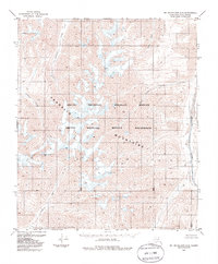
1983 Map of Mt. Michelson A-2
USGS Topo · Published 1986About this map
The Franklin Mountains dominate this 1983 survey of the Alaska North Slope, providing a detailed record of the Brooks Range interior before the turn of the 21st century. This land is primarily defined by the Arctic National Wildlife Refuge and the Arctic Wildlife Refuge Wilderness, representing an environment where no roads or trails were recorded at the time of editing. Waterways serve as the primary landmarks in this unsurveyed territory, with the Canning River and the Hulahula River framing the high elevation terrain. Smaller tributaries such as Carnivore Creek, Katuk Creek, and West Patuk Creek carve through the mountain passes, illustrating the complex drainage patterns of the Arctic watershed. The mapping reflects data from aerial photography taken in 1972, providing a precise look at the glaciated peaks and river valleys of this protected wilderness area.
Find a feature on this map
9 named features on this map. Tap any name to fly to it.
Don’t see what you’re looking for? This feature index may not catch every label — zoom into the map to look around manually.
Map Details
Editions of this 1983 Mt. Michelson A-2 Map
2 editions found
Other maps of this area

1951 · Arctic
USGS Topo · 1:250,000

1951 · Mt. Michelson
USGS Topo · 1:250,000

1955 · Mount Michelson B-1
USGS Topo · 1:63,360

1956 · Arctic
USGS Topo · 1:250,000

1956 · Mt. Michelson
USGS Topo · 1:250,000

1956 · Mount Michelson B-2
USGS Topo · 1:63,360

1956 · Mount Michelson B-3
USGS Topo · 1:63,360

1983 · Mount Michelson A-3
USGS Topo · 1:63,360
1983 · Mount Michelson A-1
USGS Topo · 1:63,360

1983 · Mount Michelson A-2
USGS Topo · 1:63,360