
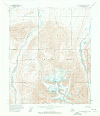
1955 Map of Mount Michelson B-1
USGS Topo · Published 1956About this map
Mount Michelson anchors this mid-century survey of the Brooks Range, rising as a prominent landmark within the northern reaches of the Arctic National Wildlife Range. The landscape is defined by its drainage systems, where the Hulahula River and Okpilak River flow northward toward the Arctic coast. This edition captures the extent of the Esetuk Glacier as it appeared during the 1950s, a period before significant modern glacial retreat was widely documented. The topography is intricately detailed, showing the relationship between high peaks like Tugak Peak and the numerous named tributaries such as Old Man Creek and Esetuk Creek. With no roads or trails indicated, the map highlights a remote wilderness characterized by steep elevation changes and high-altitude water bodies like Okpilak Lake.
Find a feature on this map
13 named features on this map. Tap any name to fly to it.
Don’t see what you’re looking for? This feature index may not catch every label — zoom into the map to look around manually.
Map Details
Editions of this 1955 Mount Michelson B-1 Map
2 editions found
Other maps of this area

1951 · Demarcation Point
USGS Topo · 1:250,000

1951 · Mt. Michelson
USGS Topo · 1:250,000

1955 · Demarcation Point
USGS Topo · 1:250,000

1955 · Mount Michelson C-1
USGS Topo · 1:63,360

1955 · Demarcation Point C-5
USGS Topo · 1:63,360

1955 · Mount Michelson C-2
USGS Topo · 1:63,360

1956 · Mt. Michelson
USGS Topo · 1:250,000

1956 · Demarcation Point B-5
USGS Topo · 1:63,360

1956 · Mount Michelson B-2
USGS Topo · 1:63,360

1964 · Demarcation Point
USGS Topo · 1:250,000