
1955 Map of Mount Michelson C-1
USGS Topo · Published 1964About this map
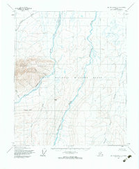
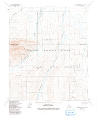
The Arctic National Wildlife Range dominates this mid-century survey of Alaska's North Slope, showing a landscape defined by braided river systems and the northern reaches of the Brooks Range. The Hulahula River and Akutoktak River cut prominent north-south paths through the terrain, illustrating the drainage patterns of the high Arctic. To the west, the Sadlerochit Mountains rise sharply, providing a dramatic backdrop to Kingak Hill and the distinctive Kingak Cliff. This sheet, based on 1955 aerial photography and field annotations, captures the region before its later designations, featuring numerous unnamed tributaries and watercourses like Itkilyariak Creek and Aretic Creek. The mapping reflects early Bureau of Land Management efforts to predetermine land lines in this unsurveyed territory of the Umiat Meridian.
Find a feature on this map
10 named features on this map. Tap any name to fly to it.
Don’t see what you’re looking for? This feature index may not catch every label — zoom into the map to look around manually.
Map Details
Editions of this 1955 Mount Michelson C-1 Map
3 editions found
Other maps of this area

1951 · Demarcation Point
USGS Topo · 1:250,000

1951 · Mt. Michelson
USGS Topo · 1:250,000

1955 · Demarcation Point
USGS Topo · 1:250,000

1955 · Mount Michelson B-1
USGS Topo · 1:63,360

1955 · Demarcation Point C-5
USGS Topo · 1:63,360

1955 · Mount Michelson C-2
USGS Topo · 1:63,360

1955 · Mount Michelson D-2
USGS Topo · 1:63,360

1955 · Mount Michelson D-1
USGS Topo · 1:63,360

1955 · Demarcation Point D-5
USGS Topo · 1:63,360

1956 · Mt. Michelson
USGS Topo · 1:250,000