
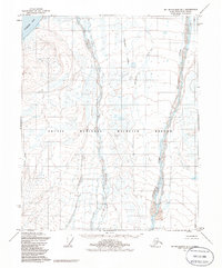
1955 Map of Mount Michelson D-1
USGS Topo · Published 1970About this map
Camden Bay and the northern shoreline of the Arctic National Wildlife Range dominate this mid-century topographic record of the North Slope. Braided water systems like the Sadlerochit River and the Hulahula River carve through the coastal plain, illustrating the complex drainage patterns typical of this arctic environment. These river systems, along with Katakturok Creek and Nataroarok Creek, flow northward from the foothills toward the Beaufort Sea.
Find a feature on this map
8 named features on this map. Tap any name to fly to it.
Don’t see what you’re looking for? This feature index may not catch every label — zoom into the map to look around manually.
Map Details
Editions of this 1955 Mount Michelson D-1 Map
2 editions found
Other maps of this area

1951 · Barter Island
USGS Topo · 1:250,000

1951 · Demarcation Point
USGS Topo · 1:250,000

1951 · Mt. Michelson
USGS Topo · 1:250,000

1955 · Flaxman Island
USGS Topo · 1:250,000

1955 · Demarcation Point
USGS Topo · 1:250,000

1955 · Mount Michelson C-1
USGS Topo · 1:63,360

1955 · Demarcation Point C-5
USGS Topo · 1:63,360

1955 · Mount Michelson C-2
USGS Topo · 1:63,360

1955 · Flaxman Island A-1
USGS Topo · 1:63,360

1955 · Mount Michelson D-2
USGS Topo · 1:63,360