
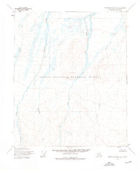
1955 Map of Demarcation Point C-5
USGS Topo · Published 1964About this map
Braided river systems and glacial valleys dominate this 1955 survey of the northern Alaskan wilderness within the Arctic National Wildlife Range. The landscape is defined by the parallel paths of the Okpilak River and the Jago River, which flow northward from the Brooks Range toward the Beaufort Sea. These vast, shifting watercourses are characterized by numerous bars and channels, reflecting a high-latitude environment of seasonal melt and sediment transport.
Find a feature on this map
6 named features on this map. Tap any name to fly to it.
Don’t see what you’re looking for? This feature index may not catch every label — zoom into the map to look around manually.
Map Details
Editions of this 1955 Demarcation Point C-5 Map
2 editions found
Other maps of this area

1951 · Demarcation Point
USGS Topo · 1:250,000

1951 · Mt. Michelson
USGS Topo · 1:250,000

1955 · Demarcation Point
USGS Topo · 1:250,000

1955 · Mount Michelson B-1
USGS Topo · 1:63,360

1955 · Mount Michelson C-1
USGS Topo · 1:63,360

1955 · Demarcation Point C-4
USGS Topo · 1:63,360

1955 · Mount Michelson D-1
USGS Topo · 1:63,360

1955 · Demarcation Point D-5
USGS Topo · 1:63,360

1955 · Demarcation Point D-4
USGS Topo · 1:63,360

1956 · Mt. Michelson
USGS Topo · 1:250,000