
1955 Map of Demarcation Point C-4
USGS Topo · Published 1968About this map
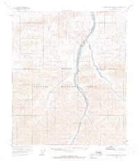
The Arctic National Wildlife Range dominates this mid-century survey of the North Slope, where the drainage systems of several significant rivers converge as they flow toward the Beaufort Sea. The braided channels of the Aichlik River cut through the southeast, while the Okerokovik River and Niguanak River establish the hydrological pattern of the central and western sections. Grounded in 1955 aerial photography and Army Map Service data, this map captures the region when land lines were still largely unsurveyed and predetermined by the Bureau of Land Management. Local terrain landmarks such as Oker and Hula provide the few named reference points in a landscape characterized by tundra polygons and wetlands. The map reflects a moment in the mid-1950s when this remote northern frontier was being systematically documented for resource management and conservation purposes.
Find a feature on this map
7 named features on this map. Tap any name to fly to it.
Don’t see what you’re looking for? This feature index may not catch every label — zoom into the map to look around manually.
Map Details
Editions of this 1955 Demarcation Point C-4 Map
This is the sole edition of this map. No revisions or reprints were ever made.
Other maps of this area

1951 · Demarcation Point
USGS Topo · 1:250,000

1955 · Demarcation Point
USGS Topo · 1:250,000

1955 · Demarcation Point C-5
USGS Topo · 1:63,360

1955 · Demarcation Point D-3
USGS Topo · 1:63,360

1955 · Demarcation Point D-5
USGS Topo · 1:63,360

1955 · Demarcation Point D-4
USGS Topo · 1:63,360

1955 · Demarcation Point C-3
USGS Topo · 1:63,360
1956 · Demarcation Point B-4
USGS Topo · 1:63,360

1956 · Demarcation Point B-5
USGS Topo · 1:63,360
1956 · Demarcation Point B-3
USGS Topo · 1:63,360