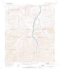
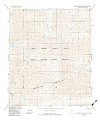
1956 Map of Demarcation Point B-4
USGS Topo · Published 1966About this map
Arctic National Wildlife Range lands dominate this mid-century survey of the North Slope, revealing a landscape defined by braided glacial river systems. The Aichilik River snakes through the eastern portion of the quadrangle, while the Okerokovik River traverses the western terrain. Mapped primarily through photogrammetric methods from 1956 aerial photographs, the sheet illustrates the topographic transition from the high Brooks Range foothills toward the coastal plain. A prominent Base Line bisects the region, marking the early efforts of the Bureau of Land Management to establish land lines across this unsurveyed territory. The map serves as a primary record of the hydrological patterns of these arctic waterways before subsequent decades of environmental shifts and expanded regional oversight.
Find a feature on this map
4 named features on this map. Tap any name to fly to it.
Don’t see what you’re looking for? This feature index may not catch every label — zoom into the map to look around manually.
Map Details
Editions of this 1956 Demarcation Point B-4 Map
2 editions found
Other maps of this area

1951 · Demarcation Point
USGS Topo · 1:250,000

1955 · Demarcation Point
USGS Topo · 1:250,000

1955 · Demarcation Point C-5
USGS Topo · 1:63,360

1955 · Demarcation Point C-4
USGS Topo · 1:63,360

1955 · Demarcation Point C-3
USGS Topo · 1:63,360

1956 · Demarcation Point B-5
USGS Topo · 1:63,360
1956 · Demarcation Point B-3
USGS Topo · 1:63,360

1964 · Demarcation Point
USGS Topo · 1:250,000
1983 · Demarcation Point A-5
USGS Topo · 1:63,360
1983 · Demarcation Point A-4
USGS Topo · 1:63,360