
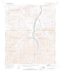
1956 Map of Demarcation Point B-5
USGS Topo · Published 1966About this map
The Arctic National Wildlife Range dominates this mid-century survey, illustrating a landscape defined by massive ice fields and the high peaks of the Brooks Range. The southern portion of the map is a complex network of moving ice, including the expansive McCall Glacier, Hubley Glacier, and the Schwanda Glacier. These glacial systems feed the braided headwaters of the Jago River and Okpilak River, which flow northward across the tundra toward the Arctic Ocean.
Find a feature on this map
28 named features on this map. Tap any name to fly to it.
Don’t see what you’re looking for? This feature index may not catch every label — zoom into the map to look around manually.
Map Details
Editions of this 1956 Demarcation Point B-5 Map
This is the sole edition of this map. No revisions or reprints were ever made.
Other maps of this area

1951 · Demarcation Point
USGS Topo · 1:250,000

1951 · Mt. Michelson
USGS Topo · 1:250,000

1955 · Demarcation Point
USGS Topo · 1:250,000

1955 · Mount Michelson B-1
USGS Topo · 1:63,360

1955 · Mount Michelson C-1
USGS Topo · 1:63,360

1955 · Demarcation Point C-5
USGS Topo · 1:63,360

1955 · Demarcation Point C-4
USGS Topo · 1:63,360

1956 · Mt. Michelson
USGS Topo · 1:250,000
1956 · Demarcation Point B-4
USGS Topo · 1:63,360

1964 · Demarcation Point
USGS Topo · 1:250,000