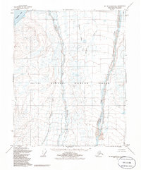
1955 Map of Mt. Michelson D-1
USGS Topo · Published 1986About this map
The Arctic National Wildlife Refuge dominates this northern landscape, which was documented by the Bureau of Land Management and other agencies following mid-century aerial surveys. The terrain is defined by the braided path of the Hulahula River to the east and the Sadlerochit River winding through the center, both flowing toward the coastal waters of Camden Bay. These river systems, along with smaller tributaries like Kojutakrok Creek and Natararoak Creek, illustrate the complex drainage patterns of the North Slope. Near the coastline, the label Koganak marks a point of interest on the bay. The map reflects a period of transition in the 1950s when remote coastal areas were being systematically charted using photogrammetric methods, prior to the formal establishment of current federal reservation boundaries.
Find a feature on this map
9 named features on this map. Tap any name to fly to it.
Don’t see what you’re looking for? This feature index may not catch every label — zoom into the map to look around manually.
Map Details
Editions of this 1955 Mt. Michelson D-1 Map
2 editions found

Other maps of this area

1951 · Barter Island
USGS Topo · 1:250,000

1951 · Demarcation Point
USGS Topo · 1:250,000

1951 · Mt. Michelson
USGS Topo · 1:250,000

1955 · Flaxman Island
USGS Topo · 1:250,000

1955 · Demarcation Point
USGS Topo · 1:250,000

1955 · Mount Michelson C-1
USGS Topo · 1:63,360

1955 · Demarcation Point C-5
USGS Topo · 1:63,360

1955 · Mount Michelson C-2
USGS Topo · 1:63,360

1955 · Flaxman Island A-1
USGS Topo · 1:63,360

1955 · Mount Michelson D-2
USGS Topo · 1:63,360