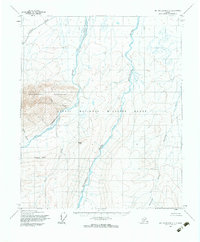
1955 Map of Mount Michelson C-1
USGS Topo · Published 1983About this map
The Arctic National Wildlife Range dominates this mid-century landscape of the North Slope, revealing a wilderness defined by water and high relief. The Sadlerochit Mountains rise sharply in the western half of the sheet, where Sadlerochit River and its tributaries like East Creek and Ledge Creek carve through the terrain. To the east, the broad course of the Hulahula River flows northward toward the coast, joined by the winding Akutoktak River. This survey, based on 1955 aerial photography, documents the region before modern infrastructure, showing prominent natural landmarks such as Kingak Hill and Kingak Cliff. The absence of roads or trails emphasizes the preservation of this tundra ecosystem, while the predetermined land lines from the Bureau of Land Management indicate the early stages of formal administrative mapping in this remote Arctic territory.
Find a feature on this map
11 named features on this map. Tap any name to fly to it.
Don’t see what you’re looking for? This feature index may not catch every label — zoom into the map to look around manually.
Map Details
Editions of this 1955 Mount Michelson C-1 Map
3 editions found
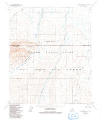
Other maps of this area

1951 · Demarcation Point
USGS Topo · 1:250,000

1951 · Mt. Michelson
USGS Topo · 1:250,000

1955 · Demarcation Point
USGS Topo · 1:250,000

1955 · Mount Michelson B-1
USGS Topo · 1:63,360

1955 · Mount Michelson C-1
USGS Topo · 1:63,360

1955 · Demarcation Point C-5
USGS Topo · 1:63,360

1955 · Mount Michelson C-2
USGS Topo · 1:63,360

1955 · Mount Michelson D-2
USGS Topo · 1:63,360

1955 · Mount Michelson D-1
USGS Topo · 1:63,360

1955 · Demarcation Point D-5
USGS Topo · 1:63,360