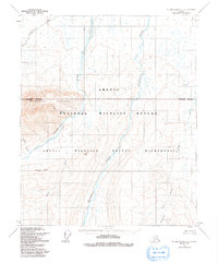
1955 Map of Mt. Michelson C-1
USGS Topo · Published 1991About this map
Sadlerochit Mountains dominate the western portion of this 1955 survey, where the peaks drop sharply toward the north. The drainage patterns here are exceptionally clear, with the Hulahula River and Sadlerochit River carving through the landscape. This area, largely defined by the Arctic National Wildlife Refuge, remains free of permanent human infrastructure, representing an unsurveyed and unmarked expanse as designated by the Bureau of Land Management.
Find a feature on this map
14 named features on this map. Tap any name to fly to it.
Don’t see what you’re looking for? This feature index may not catch every label — zoom into the map to look around manually.
Map Details
Editions of this 1955 Mt. Michelson C-1 Map
3 editions found
Other maps of this area

1951 · Demarcation Point
USGS Topo · 1:250,000

1951 · Mt. Michelson
USGS Topo · 1:250,000

1955 · Demarcation Point
USGS Topo · 1:250,000

1955 · Mount Michelson B-1
USGS Topo · 1:63,360

1955 · Mount Michelson C-1
USGS Topo · 1:63,360

1955 · Demarcation Point C-5
USGS Topo · 1:63,360

1955 · Mount Michelson C-2
USGS Topo · 1:63,360

1955 · Mount Michelson D-2
USGS Topo · 1:63,360

1955 · Mount Michelson D-1
USGS Topo · 1:63,360

1955 · Demarcation Point D-5
USGS Topo · 1:63,360