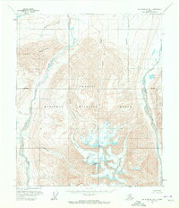
1955 Map of Mount Michelson B-1
USGS Topo · Published 1972About this map
Mount Michelson and Tugak Peak dominate this mid-century survey of the Brooks Range, situated within the Arctic National Wildlife Range. The landscape is defined by the massive Esetuk Glacier, which feeds a network of north-flowing water systems including Esetuk Creek and Kolotuk Creek. These streams eventually join the braided channels of the Hulahula River and the Okpilak River as they cut through the high elevations of Kikiktat Mountain. Based on aerial photography from the mid-1950s, the map illustrates a completely roadless wilderness where drainage patterns and glacial formations are the primary landmarks. Smaller water bodies like Okpilak Lake and Woman Creek provide additional orientation in this remote region, which was mapped before many of these features were formally protected or widely documented.
Find a feature on this map
14 named features on this map. Tap any name to fly to it.
Don’t see what you’re looking for? This feature index may not catch every label — zoom into the map to look around manually.
Map Details
Editions of this 1955 Mount Michelson B-1 Map
2 editions found
Other maps of this area

1951 · Demarcation Point
USGS Topo · 1:250,000

1951 · Mt. Michelson
USGS Topo · 1:250,000

1955 · Demarcation Point
USGS Topo · 1:250,000

1955 · Mount Michelson B-1
USGS Topo · 1:63,360

1955 · Mount Michelson C-1
USGS Topo · 1:63,360

1955 · Demarcation Point C-5
USGS Topo · 1:63,360

1955 · Mount Michelson C-2
USGS Topo · 1:63,360

1956 · Mt. Michelson
USGS Topo · 1:250,000

1956 · Demarcation Point B-5
USGS Topo · 1:63,360

1956 · Mount Michelson B-2
USGS Topo · 1:63,360