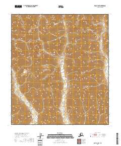
2018 Map of Arctic C-5 SE
USGS Topo · Published 2018About this map
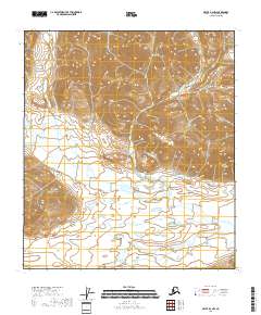
Marsh Fork meanders through this section of the Arctic C-5 SE quadrangle, its waters defining the northern drainage pattern amidst a high-altitude landscape. The map highlights the vast terrain of the North Slope, organized by the Public Land Survey System grids of t9s r23e, t9s r24e, and t10s r24e. This specific 2018 survey provides an essential view of the untouched wilderness, where elevation contours and hydrography are the primary features. It serves as a precise record of the remote Alaskan interior, showing the natural course of the Marsh Fork before any modern infrastructure touched these townships.
Find a feature on this map
7 named features on this map. Tap any name to fly to it.
Don’t see what you’re looking for? This feature index may not catch every label — zoom into the map to look around manually.
Map Details
Editions of this 2018 Arctic C-5 SE Map
This is the sole edition of this map. No revisions or reprints were ever made.
Other maps of this area

1951 · Arctic
USGS Topo · 1:250,000

1956 · Arctic
USGS Topo · 1:250,000
1971 · Arctic C-5
USGS Topo · 1:63,360
1981 · Arctic B-5
USGS Topo · 1:63,360
1983 · Arctic B-4
USGS Topo · 1:63,360
1983 · Arctic C-4
USGS Topo · 1:63,360
2018 · Arctic B-5 NE
USGS Topo · 1:25,000
2018 · Arctic C-4 SW
USGS Topo · 1:25,000
2018 · Arctic C-4 NW
USGS Topo · 1:25,000
2018 · Arctic B-4 NW
USGS Topo · 1:25,000