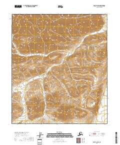
2018 Map of Arctic D-4 SW
USGS Topo · Published 2018About this map
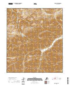
The northern edge of the Brooks Range in Alaska’s North Slope Borough reveals a landscape defined by extreme relief and the winding course of the Marsh Fork. This 2018 study of the terrain captures the transition between high ridges and the valley floor, where the water flows northward toward the Arctic Ocean. The map is primarily organized by the Public Land Survey System, illustrating the townships of t6s r24e, t6s r25e, t7s r24e, t7s r25e, t8s r24e, and t8s r25e. Unlike more settled regions, this area is devoid of roads or permanent structures, reflecting a wilderness state maintained into the early 21st century. The intricate contour lines provide a specialized view of the drainage patterns and peaks that characterize this part of the Arctic landscape.
Find a feature on this map
7 named features on this map. Tap any name to fly to it.
Don’t see what you’re looking for? This feature index may not catch every label — zoom into the map to look around manually.
Map Details
Editions of this 2018 Arctic D-4 SW Map
This is the sole edition of this map. No revisions or reprints were ever made.
Other maps of this area

1951 · Arctic
USGS Topo · 1:250,000

1956 · Arctic
USGS Topo · 1:250,000
1971 · Arctic D-5
USGS Topo · 1:63,360
1971 · Arctic C-5
USGS Topo · 1:63,360
1983 · Arctic D-4
USGS Topo · 1:63,360
1983 · Arctic C-4
USGS Topo · 1:63,360
2018 · Arctic C-4 NW
USGS Topo · 1:25,000
2018 · Arctic D-4 NW
USGS Topo · 1:25,000
2018 · Arctic D-5 SE
USGS Topo · 1:25,000
2018 · Arctic C-5 NE
USGS Topo · 1:25,000