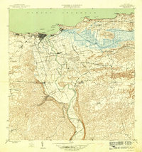
1946 Map of Arecibo
USGS Topo · Published 1946About this map
Arecibo stands as a bustling coastal hub in the mid-1940s, its urban grid tightly clustered against the Océano Atlántico while an intricate rail network branches southward into the sugarcane lands. The American Railroad of Porto Rico traces the shoreline, connecting the main Estacion Arecibo to the wider island infrastructure, while the specialized Central Cambalache RR services the industrial sugar mills near Estación Cambalache.
Find a feature on this map
64 named features on this map. Tap any name to fly to it.
Don’t see what you’re looking for? This feature index may not catch every label — zoom into the map to look around manually.
Map Details
Editions of this 1946 Arecibo Map
3 editions found
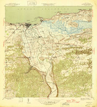
Other maps of this area

1938 · Camuy
USGS Topo · 1:20,000

1942 · Arecibo
USGS Topo · 1:30,000

1942 · Camuy
USGS Topo · 1:30,000

1942 · Barceloneta
USGS Topo · 1:30,000

1943 · Utuado NE
USGS Topo · 1:10,000

1946 · Barceloneta
USGS Topo · 1:30,000

1946 · Utuado
USGS Topo · 1:30,000

1946 · Bayaney
USGS Topo · 1:30,000

1946 · Arecibo
USGS Topo · 1:30,000

1946 · Florida
USGS Topo · 1:30,000