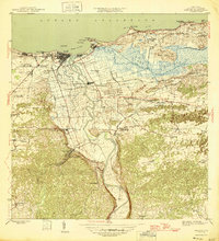
1946 Map of Arecibo
USGS Topo · Published 1946About this map
Arecibo stands as the primary hub along the northern coast of Puerto Rico in this mid-1940s survey, where the American Railroad of Porto Rico and the sugar-processing operations of Central Cambalache dominate the local economy. The landscape is defined by the winding course of the Río Grande de Arecibo, which feeds into the Puerto Arecibo harbor near Pta Morrillos. To the east, the extensive wetlands of Caño Tiburones contrast with the rugged, limestone-pockmarked interior to the south. This era shows a dense network of local settlements and infrastructure, including the Hospital Distrito de Arecibo and the Escuela Segunda Unidad de Bajadero, reflecting the social and industrial growth of the region before modern highway expansion altered traditional transit routes through areas like Poblado Santana and Bajadero.
Find a feature on this map
57 named features on this map. Tap any name to fly to it.
Don’t see what you’re looking for? This feature index may not catch every label — zoom into the map to look around manually.
Map Details
Editions of this 1946 Arecibo Map
3 editions found
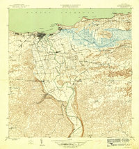
Other maps of this area

1938 · Camuy
USGS Topo · 1:20,000

1942 · Arecibo
USGS Topo · 1:30,000

1942 · Camuy
USGS Topo · 1:30,000

1942 · Barceloneta
USGS Topo · 1:30,000

1943 · Utuado NE
USGS Topo · 1:10,000

1946 · Barceloneta
USGS Topo · 1:30,000

1946 · Utuado
USGS Topo · 1:30,000

1946 · Bayaney
USGS Topo · 1:30,000

1946 · Arecibo
USGS Topo · 1:30,000

1946 · Florida
USGS Topo · 1:30,000