
1946 Map of Arecibo
USGS Topo · Published 1946About this map
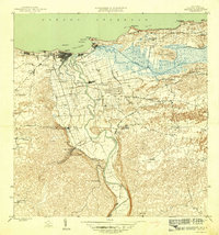
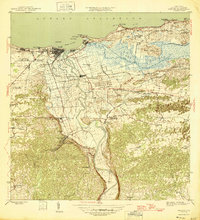
The coastal city of Arecibo and its surrounding sugar-producing hinterlands are detailed in this mid-1940s survey. Industrial activity is centered on the massive Central Cambalache and Central Los Canos sugar mills, which are connected by the American Railroad of Porto Rico. The landscape is dominated by the wide drainage of the Caño Tiburones and the winding Rio Grande de Arecibo, which feeds the municipal Aqueducto de Arecibo Planta de Filtracion. Settlement patterns reveal dense neighborhoods like Miramar and Buenos Aires near the port at La Marina, contrasted with rural barrios such as Domingo Ruiz and Sabana Hoyos. Local infrastructure includes the San Luis Hospital Distrito de Arecibo and the Escuela Segunda Unidad de Bajadero, providing a snapshot of the region's social and economic core during the late territorial period.
Find a feature on this map
77 named features on this map. Tap any name to fly to it.
Don’t see what you’re looking for? This feature index may not catch every label — zoom into the map to look around manually.
Map Details
Editions of this 1946 Arecibo Map
3 editions found
Other maps of this area

1938 · Camuy
USGS Topo · 1:20,000

1942 · Arecibo
USGS Topo · 1:30,000

1942 · Camuy
USGS Topo · 1:30,000

1942 · Barceloneta
USGS Topo · 1:30,000

1943 · Utuado NE
USGS Topo · 1:10,000

1946 · Barceloneta
USGS Topo · 1:30,000

1946 · Utuado
USGS Topo · 1:30,000

1946 · Bayaney
USGS Topo · 1:30,000

1946 · Florida
USGS Topo · 1:30,000
1947 · Barceloneta SO
USGS Topo · 1:10,000