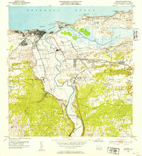
1953 Map of Arecibo
USGS Topo · Published 1954About this map
The Río Grande de Arecibo winds toward the northern coast, anchoring a landscape defined by the sugar industry and coastal development in the mid-20th century. At the river's mouth, the city of Arecibo is flanked by neighborhoods like Buenos Aires and Obrero, while the American RR of Porto Rico connects the urban center to industrial hubs like Central Cambalache. This rail network was vital for transporting sugarcane from the surrounding alluvial plains to the mills and the harbor at Puerto Arecibo.
Find a feature on this map
79 named features on this map. Tap any name to fly to it.
Don’t see what you’re looking for? This feature index may not catch every label — zoom into the map to look around manually.
Map Details
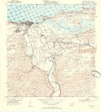
Editions of this 1953 Arecibo Map
2 editions found
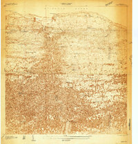
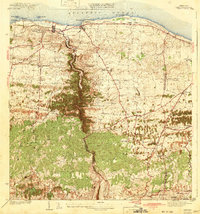
Other maps of this area
1938 · Camuy
USGS Topo · 1:20,000

1942 · Arecibo
USGS Topo · 1:30,000
1942 · Camuy
USGS Topo · 1:30,000

1942 · Barceloneta
USGS Topo · 1:30,000

1943 · Utuado NE
USGS Topo · 1:10,000

1946 · Barceloneta
USGS Topo · 1:30,000

1946 · Utuado
USGS Topo · 1:30,000

1946 · Bayaney
USGS Topo · 1:30,000

1946 · Arecibo
USGS Topo · 1:30,000

1946 · Florida
USGS Topo · 1:30,000
Featured Places
- Arecibo, Arecibo
- Reparto Capitolio, Arecibo
- Villa Vélez, Arecibo
- Sector Pueblo de Paja, Arecibo
- Ballajá, Arecibo