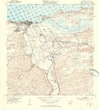
1953 Map of Arecibo
USGS Topo · Published 1954About this map
The coastal city of Arecibo and its industrial surroundings are documented here just after the post-war era, showing a landscape defined by the sugar industry and rail transport. The American RR of Porto Rico serves as a primary artery, connecting the town to the massive Central Cambalache sugar mill and the Estación Cambalache rail junction. Agricultural activity is dense along the Río Grande de Arecibo and near Central Los Caños, while the inland barrios like Domingo Ruiz and Arenalejos show a developing network of rural schools and settlements. Of particular note for local historians is the depiction of the Caño Tiburones wetlands and the Arecibo Airport during its mid-century operation. The map reveals the intricate water management system of the era, including the Planta de Filtración and El Dique, which managed the flow of the Río Tanamá.
Find a feature on this map
83 named features on this map. Tap any name to fly to it.
Don’t see what you’re looking for? This feature index may not catch every label — zoom into the map to look around manually.
Map Details
Editions of this 1953 Arecibo Map
2 editions found
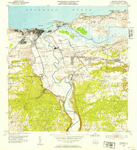
Other maps of this area

1938 · Camuy
USGS Topo · 1:20,000

1942 · Arecibo
USGS Topo · 1:30,000

1942 · Camuy
USGS Topo · 1:30,000

1942 · Barceloneta
USGS Topo · 1:30,000

1943 · Utuado NE
USGS Topo · 1:10,000

1946 · Barceloneta
USGS Topo · 1:30,000

1946 · Utuado
USGS Topo · 1:30,000

1946 · Bayaney
USGS Topo · 1:30,000

1946 · Arecibo
USGS Topo · 1:30,000

1946 · Florida
USGS Topo · 1:30,000
Featured Places
- Arecibo
- Ballajá, Arecibo
- Reparto Los Maestros, Arecibo
- Sector Pueblo de Paja, Arecibo
- El Colloral, Arecibo