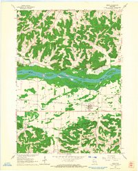
1962 Map of Arena
USGS Topo · Published 1964About this map
The Wisconsin River divides this landscape, where the flat agricultural expanse of Arena Prairie meets the dissected upland ridges of the driftless area. Settlement is concentrated along the Chicago Milwaukee St Paul and Pacific rail line, which anchors the village of Arena. To the north, the small community of Cassell sits near the riverbanks, surrounded by complex valley systems like Federman Valley and Badger Valley. The map reveals a rural economy rooted in the land, showing multiple quarries and landmarks such as Coon Rock Cave and Point Bluff. Genealogists will find significant value in the documentation of local burial sites, including Arena Cem and Davis Cem, as well as the location of St Johns Ch in the southern hills.
Find a feature on this map
26 named features on this map. Tap any name to fly to it.
Don’t see what you’re looking for? This feature index may not catch every label — zoom into the map to look around manually.
Map Details
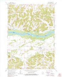
Editions of this 1962 Arena Map
2 editions found
Other maps of this area

1901 · Denzer
USGS Topo · 1:62,500

1905 · Richland Center
USGS Topo · 1:125,000

1920 · Blue Mounds
USGS Topo · 1:62,500

1922 · Blue Mounds
USGS Topo · 1:62,500

1957 · Madison
USGS Topo · 1:250,000

1958 · North Freedom
USGS Topo · 1:62,500

1958 · La Crosse
USGS Topo · 1:250,000

1960 · Madison
USGS Topo · 1:250,000

1960 · Plain
USGS Topo · 1:62,500

1960 · Spring Green
USGS Topo · 1:62,500