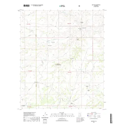
2020 Map of Ares Peak
USGS Topo · Published 2020About this map
Lincoln National Forest encompasses the rugged center of this high-desert landscape on the border of Otero and Eddy counties. The terrain is defined by a dense network of arid canyons and ridges, including Lawyer Canyon, Rawhide Canyon, and Pierce Canyon, all of which feed into the wider drainage of Rocky Arroyo. In this water-scarce environment, the presence of localized improvements like the Acrey Water Storage Tank, Lawyer Dirt Tank, and Wilson Tank points to the area's long-standing use for cattle ranching, further evidenced by the named National Livestock Road. To the south, the foothills of the Guadalupe Mountains rise toward the summit of Ares Peak, while the northern region is marked by the confluence of canyons at Three Forks. This map preserves the nomenclature of a working landscape, where every draw and ridge, such as Powers Ridge and Roberts Canyon, was identified for livestock management and navigation.
Find a feature on this map
32 named features on this map. Tap any name to fly to it.
Don’t see what you’re looking for? This feature index may not catch every label — zoom into the map to look around manually.
Map Details
Editions of this 2020 Ares Peak Map
This is the sole edition of this map. No revisions or reprints were ever made.
Other maps of this area

1935 · El Paso Gap
USGS Topo · 1:62,500

1936 · El Paso Gap
USGS Topo · 1:48,000

1940 · El Paso Gap
USGS Topo · 1:62,500

1940 · Bandanna Point
USGS Topo · 1:62,500

1940 · Carlsbad Caverns West
USGS Topo · 1:62,500

1943 · Carlsbad Caverns West
USGS Topo · 1:62,500

1943 · Bandanna Point
USGS Topo · 1:62,500

1943 · Texas Hill
USGS Topo · 1:62,500

1945 · Texas Hill
USGS Topo · 1:62,500

1954 · Carlsbad
USGS Topo · 1:250,000