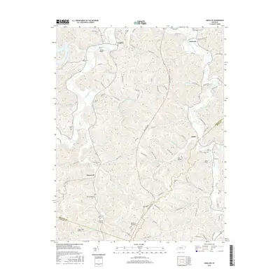
2016 Map of Argillite
USGS Topo · Published 2016About this map
Little Sandy River meanders through this portion of Greenup County, carving a landscape defined by deep hollows and narrow creek valleys. The settlement of Argillite sits at a northern bend, while the former iron-industry hub of Hunnewell is situated further south along the waters of Cane Cr. This modern survey documents a rural landscape where traditional family-named landmarks like Logtown Hollow and Wildcat Hollow coexist with newer infrastructure like the Industrial Pkwy. Genealogists will find a high density of burial sites across the ridges, including the Kentucky Veterans Cem North East near the center of the quadrangle and numerous smaller family grounds such as Grizzle Cem and Kirby Flats Cem. The terrain rises to its highest point at High Knob, overlooking a network of drainages including Sandsuck Cr and Culp Cr.
Find a feature on this map
97 named features on this map. Tap any name to fly to it.
Don’t see what you’re looking for? This feature index may not catch every label — zoom into the map to look around manually.
Map Details
Editions of this 2016 Argillite Map
This is the sole edition of this map. No revisions or reprints were ever made.
Other maps of this area

1898 · Ironton
USGS Topo · 1:62,500

1900 · Ironton
USGS Topo · 1:62,500

1901 · Ceredo
USGS Topo · 1:62,500

1903 · Kenova
USGS Topo · 1:125,000

1904 · Kenova
USGS Topo · 1:125,000

1913 · Ceredo
USGS Topo · 1:62,500

1926 · Greenup
USGS Topo · 1:48,000

1930 · Greenup
USGS Topo · 1:62,500

1953 · Grayson
USGS Topo · 1:24,000

1953 · Oldtown
USGS Topo · 1:24,000