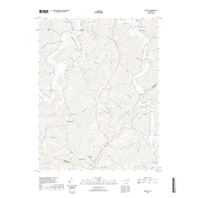
2019 Map of Argillite
USGS Topo · Published 2019About this map
Argillite and Hunnewell anchor this pocket of Greenup County, where the landscape is defined by the winding course of the Little Sandy River and its numerous tributaries like Sinking Br and Sandsuck Cr. The area’s complex topography of ridges and hollows, such as Wildcat Hollow and Logtown Hollow, dictated a settlement pattern of small communities connected by creek-side roads and gaps. Notable for its many family and community burial grounds, the sheet includes the Kentucky Veterans Cem Northeast, Reeves Cem, and Hunnewell Cem. The eastern portion of the quadrangle transitions toward Danleyton and Naples near the East Fork Little Sandy River, while distinct local landmarks like Baseball Hill and High Knob rise above the drainage basins. This geography reflects a rural Appalachian economy shaped by the narrow valleys and the intricate network of the Industrial Pkwy.
Find a feature on this map
101 named features on this map. Tap any name to fly to it.
Don’t see what you’re looking for? This feature index may not catch every label — zoom into the map to look around manually.
Map Details
Editions of this 2019 Argillite Map
This is the sole edition of this map. No revisions or reprints were ever made.
Other maps of this area

1898 · Ironton
USGS Topo · 1:62,500

1900 · Ironton
USGS Topo · 1:62,500

1901 · Ceredo
USGS Topo · 1:62,500

1903 · Kenova
USGS Topo · 1:125,000

1904 · Kenova
USGS Topo · 1:125,000

1913 · Ceredo
USGS Topo · 1:62,500

1926 · Greenup
USGS Topo · 1:48,000

1930 · Greenup
USGS Topo · 1:62,500

1953 · Grayson
USGS Topo · 1:24,000

1953 · Oldtown
USGS Topo · 1:24,000