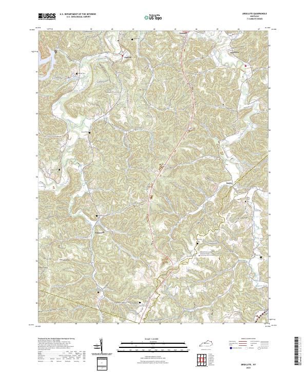
2023 Map of Argillite
USGS Topo · Published 2023About this map
The Little Sandy River and its East Fork wind through this corner of Greenup and Boyd Counties, carving a landscape of narrow hollows and steep ridges. The settlement of Argillite sits at the north, while the southern reaches are marked by the Hunnewell community and the sprawling Kentucky Veterans Cem Northeast. This terrain, characterized by features like Wildcat Hollow and Logtown Hollow, has long influenced local movement and infrastructure, seen in the modern Industrial Pkwy that cuts across the central valleys.
Find a feature on this map
100 named features on this map. Tap any name to fly to it.
Don’t see what you’re looking for? This feature index may not catch every label — zoom into the map to look around manually.
Map Details
Editions of this 2023 Argillite Map
This is the sole edition of this map. No revisions or reprints were ever made.
Other maps of this area

1898 · Ironton
USGS Topo · 1:62,500

1900 · Ironton
USGS Topo · 1:62,500

1901 · Ceredo
USGS Topo · 1:62,500

1903 · Kenova
USGS Topo · 1:125,000

1904 · Kenova
USGS Topo · 1:125,000

1913 · Ceredo
USGS Topo · 1:62,500

1926 · Greenup
USGS Topo · 1:48,000

1930 · Greenup
USGS Topo · 1:62,500

1953 · Grayson
USGS Topo · 1:24,000

1953 · Oldtown
USGS Topo · 1:24,000