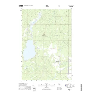
2018 Map of Argonne
USGS Topo · Published 2018About this map
Nicolet National Forest dominates this section of Forest County, where the headwaters of the Peshtigo River system emerge from glacial wetlands. The landscape is defined by its water, from the broad expanse of Pine Lake and the Hiles Millpond in the west to the winding course of the W Br Peshtigo River and Middle Br Peshtigo River. This 2018 survey captures the interface of dense forest management and small northern settlements, primarily centered around Hiles and Argonne. Local history is anchored by several burial sites, including Hiles Cem and Saint Marys Cem, and infrastructure for forest protection such as the Windsor Dam Divide Fire Tower. Transportation relies on a network of Forest Service roads and recreational routes, including the Snowmobile Trail-Lkln Forest, which thread through areas like Island Swamp and the Coyote Cr Impoundment.
Find a feature on this map
50 named features on this map. Tap any name to fly to it.
Don’t see what you’re looking for? This feature index may not catch every label — zoom into the map to look around manually.
Map Details
Editions of this 2018 Argonne Map
This is the sole edition of this map. No revisions or reprints were ever made.
Other maps of this area

1928 · Three Lakes
USGS Topo · 1:48,000

1938 · Alvin
USGS Topo · 1:48,000

1938 · Three Lakes
USGS Topo · 1:48,000

1939 · Crandon
USGS Topo · 1:48,000

1940 · Monico
USGS Topo · 1:48,000

1941 · Crandon
USGS Topo · 1:48,000

1945 · Three Lakes
USGS Topo · 1:48,000

1946 · Alvin
USGS Topo · 1:48,000

1947 · Crandon
USGS Topo · 1:48,000

1950 · Monico
USGS Topo · 1:48,000