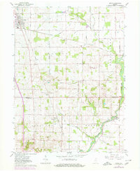
1962 Map of Argos
USGS Topo · Published 1980About this map
Argos anchors this mid-century view of the Indiana landscape, where the Norfolk and Western rail corridor intersects with a rural network of roads and drainage ditches. The map reveals the intricate engineering of the land through features like the East 16th Road Ditch and Redinger Ditch, essential for farming in Walnut, Richland, and Newcastle townships.
Find a feature on this map
38 named features on this map. Tap any name to fly to it.
Don’t see what you’re looking for? This feature index may not catch every label — zoom into the map to look around manually.
Map Details
Editions of this 1962 Argos Map
Other maps of this area

1953 · Chicago
USGS Topo · 1:250,000

1957 · Chicago
USGS Topo · 1:250,000

1957 · Inwood
USGS Topo · 1:24,000

1957 · Plymouth
USGS Topo · 1:24,000

1958 · Bourbon
USGS Topo · 1:24,000

1959 · Mentone
USGS Topo · 1:24,000

1962 · Pershing
USGS Topo · 1:24,000
1962 · Akron
USGS Topo · 1:24,000

1962 · Argos
USGS Topo · 1:24,000
1962 · Rochester
USGS Topo · 1:24,000