2024 Map of Argusville
USGS Topo · Published 2024About this map
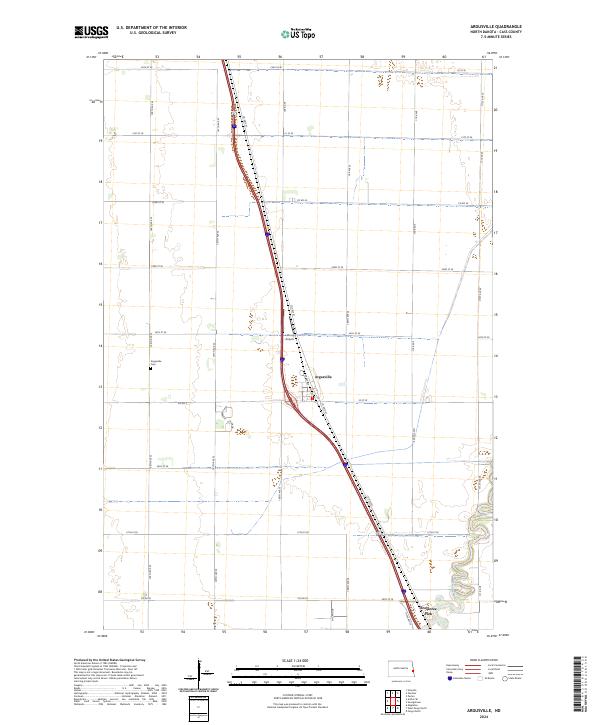
Argusville serves as the central hub of this agricultural landscape in Cass County, situated along the corridor of Co Hwy 81 and modern transport lines. The settlement's history is anchored by the Argusville Cem, located west of the town center near 166th Ave SE. The survey reflects a transition from traditional prairie sections to modern infrastructure, where the Sheyenne River meanders through the southeastern corner, providing a natural contrast to the rigid grid of county roads such as Co Rd 4 and Cass Co 81. Local aviation is represented by Lisburg Airport, positioned north of the primary townsite. The inclusion of Brooktree Park near the riverbanks indicates the development of residential or recreational spaces at the rural edge, while the surrounding townships of t142n r50w and t141n r49w remain defined by expansive section lines.
Find a feature on this map
35 named features on this map. Tap any name to fly to it.
Don’t see what you’re looking for? This feature index may not catch every label — zoom into the map to look around manually.
Map Details
Editions of this 2024 Argusville Map
This is the sole edition of this map. No revisions or reprints were ever made.
Historical Maps of Richwood Estates Through Time
Featured Locations
- Berlin Township, ND
- Gardner Township, ND
- Wiser Township, ND
- Argusville, ND
- Brooktree Park, Harwood Township