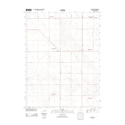
2013 Map of Arickaree
USGS Topo · Published 2013About this map
The settlement of Arickaree anchors this high-plains landscape in Washington County, where the geometric precision of the Public Land Survey System is etched into the terrain. A rigid grid of county thoroughfares, including CO Road JJ and CO Road NN, defines the property boundaries and agricultural tracts characteristic of this region. The northern edge of the map features the location of Wiladel, while Us-36 E cuts diagonally across the northern sections, providing the primary modern transportation artery through the area.
Find a feature on this map
26 named features on this map. Tap any name to fly to it.
Don’t see what you’re looking for? This feature index may not catch every label — zoom into the map to look around manually.
Map Details
Editions of this 2013 Arickaree Map
This is the sole edition of this map. No revisions or reprints were ever made.
Other maps of this area

1954 · Limon
USGS Topo · 1:250,000

1957 · Limon
USGS Topo · 1:250,000

1958 · Limon
USGS Topo · 1:250,000

1977 · Thurman
USGS Topo · 1:24,000
1977 · Elba SW
USGS Topo · 1:24,000

1977 · Arickaree
USGS Topo · 1:24,000

1977 · Elba SE
USGS Topo · 1:24,000

1977 · Anton SE
USGS Topo · 1:24,000

1977 · Cope SW
USGS Topo · 1:24,000
1978 · Anton
USGS Topo · 1:24,000