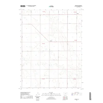
2019 Map of Arickaree
USGS Topo · Published 2019About this map
Arickaree sits at a crossroads in the High Plains of Washington County, where agricultural grid lines meet the winding path of Gordon Cr. This landscape is defined by the Public Land Survey System, with township and range lines like t4s r51w organizing the terrain into distinct sections. The settlement of Wiladel appears in the northern reaches, connected by an extensive network of county roads including Co Rd 12 and Co Rd NN. These routes trace the flat divides between drainage basins, serving the isolated farmsteads and ranching operations that characterize this part of eastern Colorado. The map documents a sparsely populated but highly structured rural environment, where the proximity to ephemeral water sources like Gordon Cr has historically dictated the placement of homesteads and infrastructure.
Find a feature on this map
23 named features on this map. Tap any name to fly to it.
Don’t see what you’re looking for? This feature index may not catch every label — zoom into the map to look around manually.
Map Details
Editions of this 2019 Arickaree Map
This is the sole edition of this map. No revisions or reprints were ever made.
Other maps of this area

1954 · Limon
USGS Topo · 1:250,000

1957 · Limon
USGS Topo · 1:250,000

1958 · Limon
USGS Topo · 1:250,000

1977 · Thurman
USGS Topo · 1:24,000
1977 · Elba SW
USGS Topo · 1:24,000

1977 · Arickaree
USGS Topo · 1:24,000

1977 · Elba SE
USGS Topo · 1:24,000

1977 · Anton SE
USGS Topo · 1:24,000

1977 · Cope SW
USGS Topo · 1:24,000
1978 · Anton
USGS Topo · 1:24,000