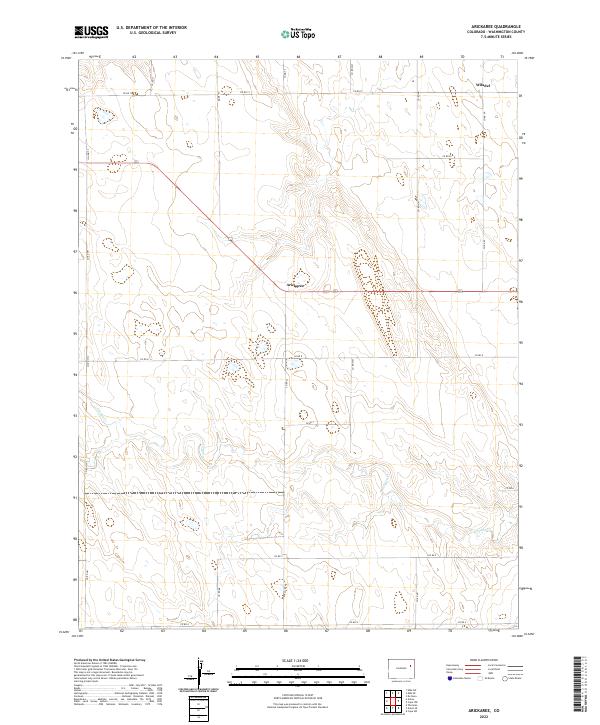
2022 Map of Arickaree
USGS Topo · Published 2022About this map
The tiny settlement of Arickaree sits at the center of this Washington County landscape, where the High Plains terrain is etched by the drainage of Gordon Cr. This 2022 survey illustrates the enduring grid of the Public Land Survey System, with township and range lines defining the organization of the modern cattle ranching and farming country. Sparse settlement patterns are evident near Wiladel in the northeastern portion of the sheet, connected by a network of section-line roads including Co Rd 12 and Co Rd 11. The map reveals how the modern road system, such as Co Rd 8 and Co Rd 4, follows the logic of 19th-century land divisions across the undulating topography of the Arickaree river basin area.
Find a feature on this map
23 named features on this map. Tap any name to fly to it.
Don’t see what you’re looking for? This feature index may not catch every label — zoom into the map to look around manually.
Map Details
Editions of this 2022 Arickaree Map
This is the sole edition of this map. No revisions or reprints were ever made.
Other maps of this area

1954 · Limon
USGS Topo · 1:250,000

1957 · Limon
USGS Topo · 1:250,000

1958 · Limon
USGS Topo · 1:250,000

1977 · Thurman
USGS Topo · 1:24,000
1977 · Elba SW
USGS Topo · 1:24,000

1977 · Arickaree
USGS Topo · 1:24,000

1977 · Elba SE
USGS Topo · 1:24,000

1977 · Anton SE
USGS Topo · 1:24,000

1977 · Cope SW
USGS Topo · 1:24,000
1978 · Anton
USGS Topo · 1:24,000