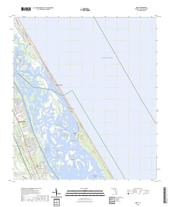
2024 Map of Ariel
USGS Topo · Published 2024About this map
Canaveral National Seashore dominates the eastern barrier island of this Volusia County coastal area, preserving a landscape defined by the intersection of the Atlantic Ocean and the vast Mosquito Lagoon. This modern survey highlights the complex waterways of the Intracoastal Waterway, where numerous islands such as Shipyard Island and Gaines Island dot the lagoon's shallow reaches. The mainland settlements of Edgewater, Ariel, and Oak Hill are depicted with their contemporary street grids, including local aviation infrastructure at the Tully RV Airpark.
Find a feature on this map
99 named features on this map. Tap any name to fly to it.
Don’t see what you’re looking for? This feature index may not catch every label — zoom into the map to look around manually.
Map Details
Editions of this 2024 Ariel Map
This is the sole edition of this map. No revisions or reprints were ever made.
Other maps of this area

1937 · Port Orange
USGS Topo · 1:48,000

1943 · Port Orange
USGS Topo · 1:62,500

1944 · Port Orange
USGS Topo · 1:62,500

1949 · Oak Hill
USGS Topo · 1:24,000

1949 · Pardon Island
USGS Topo · 1:24,000

1950 · Maytown
USGS Topo · 1:24,000

1950 · Ariel
USGS Topo · 1:24,000

1950 · Edgewater
USGS Topo · 1:24,000
1952 · Pardon Island
USGS Topo · 1:24,000

1954 · Daytona Beach
USGS Topo · 1:250,000