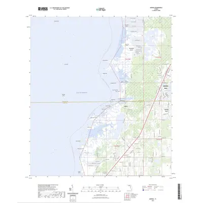
2024 Map of Aripeka
USGS Topo · Published 2024About this map
Aripeka sits at the coastal intersection of Hernando and Pasco Counties, where the transition from Gulf waters to Florida marshland is defined by a labyrinth of bayous and keys. This contemporary survey details the expansion of Spring Hill and Hernando Beach against the protected expanses of the Weeki Wachee Swamp. The landscape is a mix of planned residential development and primitive coastline, where Indian Key and Cabbage Island guard the mouth of Indian Bay.
Find a feature on this map
76 named features on this map. Tap any name to fly to it.
Don’t see what you’re looking for? This feature index may not catch every label — zoom into the map to look around manually.
Map Details
Editions of this 2024 Aripeka Map
This is the sole edition of this map. No revisions or reprints were ever made.
Other maps of this area

1954 · Port Richey
USGS Topo · 1:24,000

1954 · Fivay
USGS Topo · 1:24,000

1954 · Aripeka
USGS Topo · 1:24,000

1954 · Bayport
USGS Topo · 1:24,000

1954 · Weekiwachee Springs
USGS Topo · 1:24,000

1954 · Port Richey NE
USGS Topo · 1:24,000

1955 · Plant City
USGS Topo · 1:250,000

1958 · Plant City
USGS Topo · 1:250,000

1959 · Plant City
USGS Topo · 1:250,000

1964 · Plant City
USGS Topo · 1:250,000