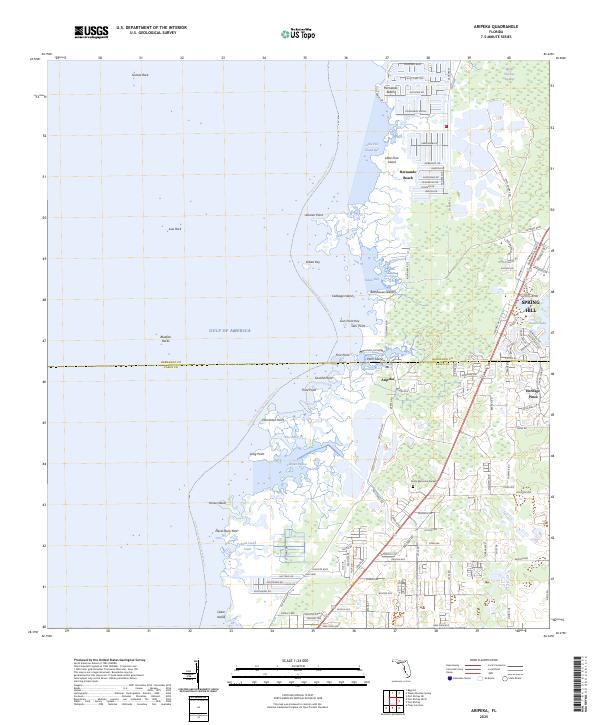
2025 Map of Aripeka
USGS Topo · Published 2025About this map
Aripeka sits at the coastal intersection of Hernando and Pasco counties, defined by a complex network of salt marshes, bayous, and limestone outcroppings. This recent survey illustrates the modern residential footprints of Hernando Beach and Spring Hill set against the wilder, undeveloped reaches of the Weeki Wachee Swamp. The coastline is a labyrinth of points and keys, from Indian Key and Cabbage Island to the fishing grounds around Gomez Rock and Bluefish Rocks in the Gulf of America. Inland, the map documents the transition from the marine environments of Fillman Bayou and Hammock Creek to established communities like Heritage Pines. This survey is particularly useful for identifying contemporary water access, including the Florida Circumnavigational Paddling Trail and landmarks like Grace Memorial Gardens.
Find a feature on this map
79 named features on this map. Tap any name to fly to it.
Don’t see what you’re looking for? This feature index may not catch every label — zoom into the map to look around manually.
Map Details
Editions of this 2025 Aripeka Map
This is the sole edition of this map. No revisions or reprints were ever made.
Other maps of this area

1954 · Port Richey
USGS Topo · 1:24,000

1954 · Fivay
USGS Topo · 1:24,000

1954 · Aripeka
USGS Topo · 1:24,000

1954 · Bayport
USGS Topo · 1:24,000

1954 · Weekiwachee Springs
USGS Topo · 1:24,000

1954 · Port Richey NE
USGS Topo · 1:24,000

1955 · Plant City
USGS Topo · 1:250,000

1958 · Plant City
USGS Topo · 1:250,000

1959 · Plant City
USGS Topo · 1:250,000

1964 · Plant City
USGS Topo · 1:250,000