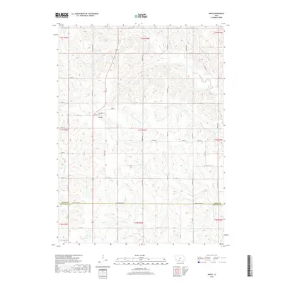
2018 Map of Arispe
USGS Topo · Published 2018About this map
Arispe sits at the heart of this Southern Iowa landscape, situated along a north-south transportation corridor that follows the ridge lines between major drainage systems. The terrain is defined by the headwaters and meandering branches of several significant watercourses, including the E Fork Grand River, Twelvemile Cr, and Sand Cr. This 2018 survey illustrates the persistent grid of rural roads, such as Nighthawk Ave and Pheasant Ave, that navigate the complex topography of the Grand River basin.
Find a feature on this map
50 named features on this map. Tap any name to fly to it.
Don’t see what you’re looking for? This feature index may not catch every label — zoom into the map to look around manually.
Map Details
Editions of this 2018 Arispe Map
This is the sole edition of this map. No revisions or reprints were ever made.
Other maps of this area

1951 · Afton
USGS Topo · 1:62,500

1954 · Omaha
USGS Topo · 1:250,000

1955 · Nebraska City
USGS Topo · 1:250,000

1957 · Nebraska City
USGS Topo · 1:250,000

1957 · Omaha
USGS Topo · 1:250,000

1958 · Omaha
USGS Topo · 1:250,000

1958 · Nebraska City
USGS Topo · 1:250,000

1980 · Creston East
USGS Topo · 1:24,000
1981 · Arispe
USGS Topo · 1:24,000
1981 · Shannon City
USGS Topo · 1:24,000