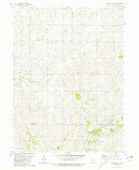
1981 Map of Shannon City
USGS Topo · Published 1981About this map
Shannon City straddles the southern border of Union County, where the iron rails of the Chicago and North Western transportation corridor parallel the Grand River. This 1981 survey reveals a landscape deeply carved by river systems, including the East Platte River and its West Branch, which define the agricultural townships of Platte and Douglas. For genealogists and local historians, the map serves as a precise guide to rural landmarks such as Harmony Cem, Mortimer Cem, and Oakland Cem. The terrain is shaped by the transition between the rolling uplands and the river valleys of Indian Creek and Plum Creek, illustrating the intersection of rail infrastructure and the natural drainage patterns that have historically dictated the placement of settlements like Kent and the surrounding farming communities.
Find a feature on this map
17 named features on this map. Tap any name to fly to it.
Don’t see what you’re looking for? This feature index may not catch every label — zoom into the map to look around manually.
Map Details
Editions of this 1981 Shannon City Map
This is the sole edition of this map. No revisions or reprints were ever made.
Other maps of this area

1951 · Afton
USGS Topo · 1:62,500

1954 · Omaha
USGS Topo · 1:250,000

1955 · Nebraska City
USGS Topo · 1:250,000

1957 · Nebraska City
USGS Topo · 1:250,000

1957 · Omaha
USGS Topo · 1:250,000

1958 · Omaha
USGS Topo · 1:250,000

1958 · Nebraska City
USGS Topo · 1:250,000

1980 · Creston East
USGS Topo · 1:24,000
1981 · Creston West
USGS Topo · 1:24,000
1981 · Arispe
USGS Topo · 1:24,000