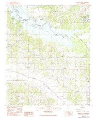
1983 Map of Arkabutla East
USGS Topo · Published 1983About this map
Arkabutla Lake dominates the northern landscape of this 1980s survey, marking the border between De Soto and Tate Counties. The reservoir, managed by the U.S. Corps of Engineers, has reshaped the valley of the Coldwater River, creating public access points like Hernando Point Public Use Area and Sunfish Bay. This era shows the developed recreation areas alongside established rural settlements such as Arkabutla and the newer residential clusters around Buena Vista Lakes.
Find a feature on this map
26 named features on this map. Tap any name to fly to it.
Don’t see what you’re looking for? This feature index may not catch every label — zoom into the map to look around manually.
Map Details
Editions of this 1983 Arkabutla East Map
This is the sole edition of this map. No revisions or reprints were ever made.
Other maps of this area

1932 · Horn Lake
USGS Topo · 1:48,000

1932 · Crenshaw
USGS Topo · 1:62,500

1935 · Crenshaw
USGS Topo · 1:62,500

1935 · Horn Lake
USGS Topo · 1:62,500

1944 · Senatobia
USGS Topo · 1:62,500

1944 · Hernando
USGS Topo · 1:62,500

1948 · Helena
USGS Topo · 1:250,000

1950 · Helena
USGS Topo · 1:250,000

1955 · Helena
USGS Topo · 1:250,000

1956 · Tupelo
USGS Topo · 1:250,000