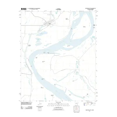
2011 Map of Arkansas City
USGS Topo · Published 2011About this map
Arkansas City sits along the massive Mississippi River Levee, anchoring a landscape defined by the shifting course of the great river. The town's grid is oriented northwest of the levee, with Mound Cemetery located just north of the central settlement. This area is characterized by the complex hydrography of the Mississippi floodplain, where numerous oxbows and backwaters like Whitehill Lake, Kate Adams Lake, and Pothole Lake reveal the river's historic wanderings.
Find a feature on this map
50 named features on this map. Tap any name to fly to it.
Don’t see what you’re looking for? This feature index may not catch every label — zoom into the map to look around manually.
Map Details
Editions of this 2011 Arkansas City Map
This is the sole edition of this map. No revisions or reprints were ever made.
Other maps of this area

1933 · Lamont
USGS Topo · 1:62,500

1936 · McGehee
USGS Topo · 1:62,500

1936 · Lake Village
USGS Topo · 1:62,500

1937 · McGehee
USGS Topo · 1:62,500

1939 · Refuge
USGS Topo · 1:62,500

1939 · Lamont
USGS Topo · 1:62,500

1953 · Greenwood
USGS Topo · 1:250,000

1955 · Lake Village
USGS Topo · 1:62,500

1955 · McGehee
USGS Topo · 1:62,500

1956 · Greenwood
USGS Topo · 1:250,000