2024 Map of Arkansas City
USGS Topo · Published 2024About this map
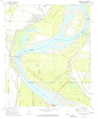
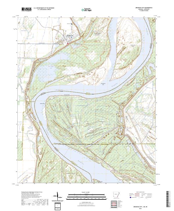
Arkansas City serves as the focal point of this riverfront survey, positioned where the Mississippi River forms the border between Arkansas and Mississippi. As the seat of Desha County, the town center is anchored by the Desha County Courthouse and a grid of streets including Delta Queen Ave and Kate Adams Ave. The surrounding landscape is defined by the hydrologic complexity of the Delta, where the Mississippi River meanders through significant loops such as Choctaw Bend and Georgetown Bend.
Find a feature on this map
64 named features on this map. Tap any name to fly to it.
Don’t see what you’re looking for? This feature index may not catch every label — zoom into the map to look around manually.
Map Details
Editions of this 2024 Arkansas City Map
This is the sole edition of this map. No revisions or reprints were ever made.